


▶ Watch Video: Hurricane Lorena could bring rain to North Texas this weekend
Tropical Storm Lorena is churning in the Pacific, bringing the possibility of life-threatening conditions and other hazards to parts of Mexico. Parts of the southwestern U.S. could also see some impacts from the storm, which was previously a hurricane.
While Lorena is quickly weakening off the coast of western Mexico, it is turning toward land — with landfall expected on Friday or early Saturday, according to CBS News and Stations meteorologist Nikki Nolan.
Baja California Sur and southwestern Sonora face a risk of life-threatening flash flooding, according to the U.S. National Hurricane Center.
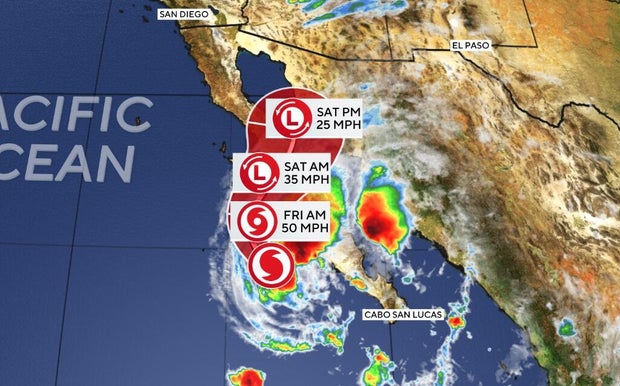
Maps show Tropical Storm Lorena’s forecast path
As of Thursday morning, Lorena was located about 125 miles west-southwest of Cabo San Lazaro, Mexico, with maximum sustained winds of 70 mph — just below the 74 mph threshold for hurricane status. It is expected to weaken for the next couple of days.
“On the forecast track, the center of Lorena is expected to move generally parallel to the west coast of the Baja California peninsula through tonight, and could move closer to the west-central coast of the Baja California peninsula while it weakens on Friday,” the hurricane center said in a Thursday morning advisory.
This map shows the projected path of the storm, as well as wind speeds, as Lorena approaches — and moves over — western Mexico:
Tropical Storm Lorena watches and warnings
A tropical storm warning — meaning tropical storm conditions are expected in the warning area within 36 hours — is in effect Thursday for the west coast of the Mexican state of Baja California Sur, from Puerto Cortes to Punta Eugenia.
A tropical storm watch — meaning tropical storm conditions are possible within the watch area within 48 hours — was discontinued for the east coast of the Baja California peninsula from Santa Rosalia to Bahia de los Angeles.
Tropical Storm Lorena’s potential impact
Forecasters say heavy rain will impact Baja California Sur and Sonora, Mexico, through Friday.
“Additional rainfall totals of 4 to 8 inches, with maximum storm total amounts of 15 inches, are possible across portions of Baja California Sur, far southeast Baja California and southwestern Sonora into Friday,” the hurricane center says. “This will bring the risk of life-threatening flash floods and mudslides, especially in areas of higher terrain.”
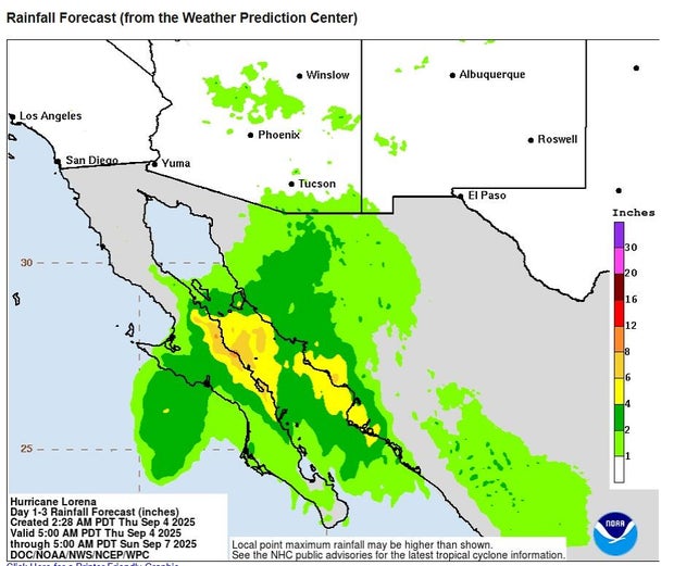
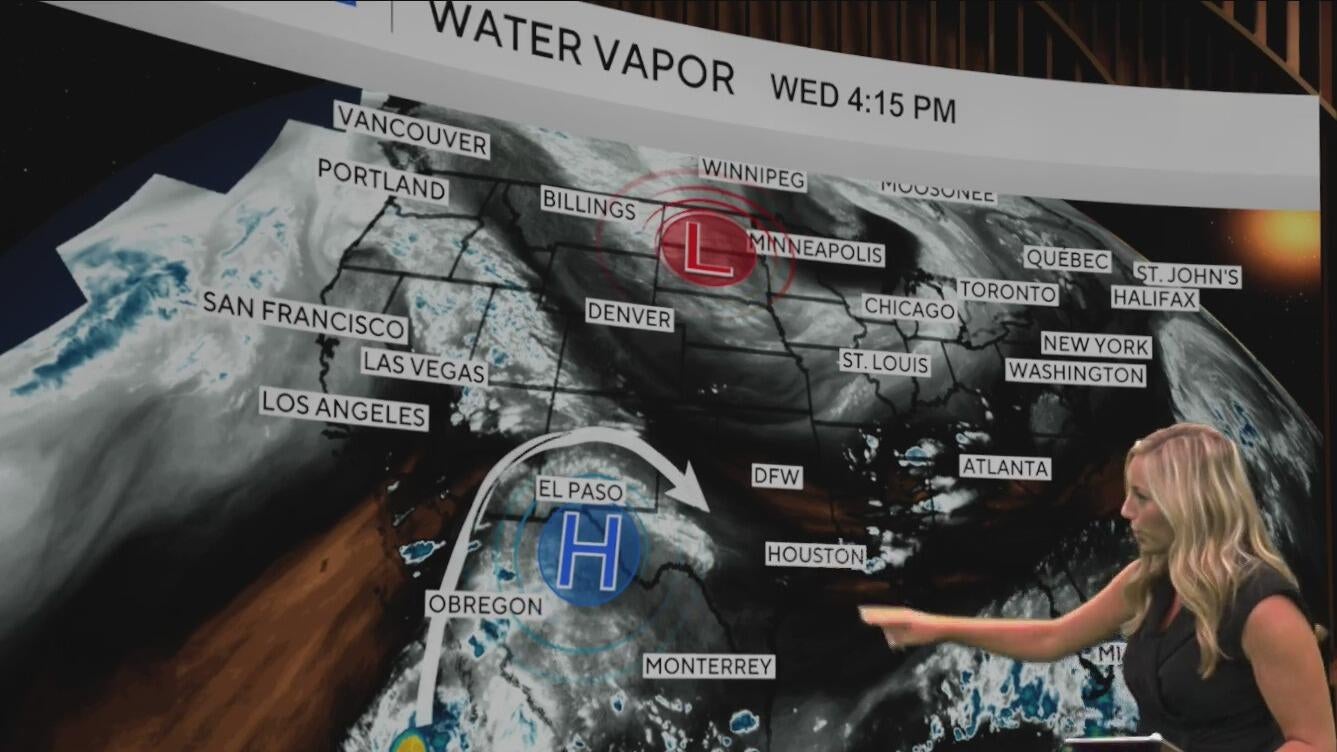
Across the southwestern U.S., 1 to 3 inches of rain — with as much as 5 inches in some areas — are forecast for parts of
Arizona and New Mexico through Saturday. That could lead to flash flooding in some places. Rain from the storm could also be seen in Texas over the weekend.
Storm surge is likely in Baja California Sur, near where Lorena makes landfall.
“Swells generated by Lorena will continue affecting portions of the south and west coasts of Baja California Sur through Friday,” the hurricane center says. “These swells are likely to cause life-threatening surf and rip current conditions.”